Official Government Website

Idaho SHPO Guidance

The purpose of this guidance is to provide a practical guide for consulting with the Idaho State Historic Preservation Office (SHPO) primarily in regard to Section 106 of the National Historic Preservation Act. This guide will be most useful to applicants, property owners, managers and those agencies without cultural resource staff, or anyone new to the process. These guidelines do not supersede more detailed Advisory Council on Historic Preservation regulations (36 CFR §800). Our guidance is offered as an introduction to the process of Section 106 Review and not as legal advice; rather it is offered as a recommendation for conducting cultural resource consultation with the Idaho SHPO.

A Microsoft Word Template of the Idaho SHPO Report Format is available to download.

Table of Contents

GUIDANCE FOR PREPARING SURVEY REPORTS

Survey reports can range from a few pages to multiple volumes, depending upon the scale and complexity of the project. Keep in mind that the purpose of the report is to provide SHPO (and future readers) with sufficient information to understand and evaluate historic properties and determine project impacts. The following document provides the preferred Idaho SHPO survey report template and details the information to include. Whether this format or another format is used, reports submitted for SHPO review may be returned to the agency for corrections/additions if the document does not provide sufficient information for SHPO staff to make informed determinations. Providing clear, detailed, and logically organized information will allow the Section 106 consultation process to move more quickly and efficiently.

By statute, the Idaho SHPO maintains the Archaeological Survey of Idaho (ASI), a repository of information and artifacts about the archaeology of Idaho, both precolonial and historic. All documents submitted to our office become part of that repository. Keep in mind that unrestricted survey results may be used by others/researchers in the future, so ideally they will “stand alone” as research documents; therefore, clearly state any assumptions or biases affecting the inventory and results.

A Microsoft Word Template of the Idaho SHPO Report Format is available online.

TITLE SHEET

Provide a title sheet for the project with title, author, author’s affiliated organization, lead federal agency (Section 106 or 110) or contracting organization (CLGs, ITD, HUD designees, etc.), survey report date, and project number.

Use consistent project names if multiple agencies and or parties are involved. Do not include abbreviations or acronyms in project titles. Any associated report, project numbers, or reference(s) should be noted.

Location

Indicate the location of the survey, including City, if applicable, and County.

Date

Date of the report.

MANAGEMENT SUMMARY (Absract)

Provide a brief summary of the survey report. Include basic contextual (locational and historical) information, survey purpose, concise analysis, and main conclusions. For example:

The purpose of this survey was to identify and document [property or site type] in [Location];

A reconnaissance/intensive cultural resource survey was conducted in ________County. A total of _____ acres were surveyed to Class II (sampling or probabilistic) /Class III (30-meter or less transects)/architectural survey standards;

Cultural resources were located in the project area that are (# eligible/# not eligible) for listing in the National Register of Historic Places;
 
#  resources were newly recorded

#  previously recorded resources were re-recorded/updated

Further work is/is not recommended prior to agency approval of the project; and/or;

The project effect finding is _____ with following avoidance stipulations are recommended:

Certification of Results: The Principal Investigator must certify that the investigation was conducted and documented according to the Secretary of the Interior’s Historic Preservation Standards and Guidelines and that the report is complete and accurate to the best of their knowledge. The Principal Investigator must meet the Secretary of the Interior’s Historic Preservation Professional Qualification Standards (62 FR 33719). If the work was contracted out rather than being conducted directly by federal agency staff, it must be completed by the appropriately professionally qualified staff (i.e., architectural historian for built environment work, archaeologist for archaeological work). A signature and date must document this certification.

Project Description

Explain the purpose of the report/study. For Section 106 projects, specify the federal agency and nexus (e.g., federal funding, license, permit, action on federal land). If a federal agency is delegating its consultation responsibility to another party, explain, and specify the agency and the designee. If the report is not completed for Section 106 compliance, indicate its purpose.

For Section 106, describe the undertaking and proposed work. Identify all anticipated ground-disturbing activities (if any), including depth and width. Address the anticipated demolition of existing buildings or structures or describe in detail any proposed alterations. Specify if new buildings or structures are proposed and describe their location. Include any maps and figures which will support thorough understanding of the extent of the project (e.g., aerials, photographs, sketch maps, etc.)

Project Area of Potential Effect (APE)

REQUIRED: Include a 7.5-minute series USGS 1:24,000 scale topographic map(s) that clearly identifies the project location. Area of Potential Effect (APE) for Section 106 Reviews

Describe the area of potential effect and provide justification for how it was determined. The APE must take into consideration direct, indirect, and cumulative effects. Indicate if there are multiple areas of potential effect, for instance, a physical APE may differ from a visual APE. Consult with the SHPO if you have questions about defining the APE.

Include a map which clearly identifies the APE and the precise location of the undertaking activity. Maps generated from GIS must include the USGS Topographic basemap (7.5-minute series USGS 1:24,000 scale). Also provide a larger scale map to show greater detail

ENVIRONMENTAL SETTING

For archaeological surveys: provide a brief description of both the present and past environments of the project area. Describe the general topography, geology, and vegetation of the area. Feel free to cite references but provide them in the reference section. Indicate if there have been any drastic changes during the anthropogenic use of the area (glaciation, flooding, fires, intensive grazing, farming, etc.).

For a built environment survey: describe the setting of the built environment, including streetscape, road types (gravel, paved, boulevard), the surrounding landscaping (planted lawns, urban gardens, meadows, desert rocks, tree-lined streets), built features (sidewalks, mailbox placement, medians, setbacks), and other character defining features of the surrounding area.

Submit a minimum of two (2) clear overview photographs of the project area in ICRIS.

Cultural Context

The significance of a historic property can only be determined and understood when evaluated within its historic or cultural context. Provide enough historic overview or cultural history of the area specific to the types of cultural resources that are known to be present, for readers to gain an understanding of the context. Indicate which cultures, ethnicities, and groups are known or suspected to have inhabited or utilized the area in the past. Describe any known traditional uses of the area. Address all relevant contexts up to the modern era (at least 45-years before present), but weight the text to reflect the resources documented in the survey.

Pre-Field Research and previous studies

The standard literature review buffer is 1-mile from the APE or 1/2-mile for a linear APE. If a project would like to deviate from the standard search area, please consult with the appropriate SHPO reviewer or email us shpo@ishs.idaho.gov. 

Previous Cultural Resource Reports

Using ICRIS, review previous studies in the APE and provide a brief analysis/summary, including the types of undertakings, survey designs, and results. Indicate whether or not the previous fieldwork meets current standards for inventory of cultural resources in Idaho. This evaluation, along with the cultural context, is meant to guide the design of the project survey strategy. The bibliographic information (title, authors, year, report numbers, and results) can be summarized in a table or a report appendix.

In addition to these previous studies, consult other sources, such as Federal agency files, cultural overviews, architectural records, ethnographic studies, patent records, local preservation commissions, universities, historical societies, knowledgeable individuals, and historic maps:

  • Government land office plats
  • USGS quadrangle maps
  • Historic aerials
  • Sanborn maps
  • Metsker maps

Previously Identified Resources

Review previously identified resources within the APE and provide a summery discussion. Indicate if previously documented cultural resources are associated with environmental variables: landforms, water, vegetation, relief, fauna, etc. Briefly discuss broad themes of anthropogenic use, identifying temporal periods of greater or lesser intensity of use. 

CONSULTATION SUMMARY

Document the extent and results of consultation and outreach with Native American tribes/groups, local governments, individuals, organizations, and other interested parties. Include any response letters received in an appendix.

FIELD METHODOLOGY

Indicate when and by whom the fieldwork was conducted. Fieldwork crew must be supervised by the appropriate qualified professional who meets the Secretary of Interior’s Professional Qualification Standards for Archaeology. Include résumés of supervising personnel as an appendix to the survey report or upload your qualifications into ICRIS under your user profile.

Define the level of intensity used for conducting the survey. If it is a variation from the SHPO standard, justify the methodology used.

Describe survey techniques (transect distance, STPs, drones, etc.) employed and the rationale for use for the particular survey. If multiple methodologies or sampling strategies were employed, explain in the narrative and indicate the locations for each on the required survey map. Survey methods should be thoroughly explained so that future readers can understand possible limitations or biases.

Acres Surveyed

Add survey areas within ICRIS—delineate between archaeological survey (Class II/III) and architectural survey. All areas surveyed must be reported whether or not resources are found. Denote the project acreage, survey acreage, and the amount of acreage covered by the pedestrian field inventory (Class II or III). Intensive archaeological survey (Class III) is defined as pedestrian transects spaced no more than 30 meters apart. If reconnaissance or sample survey is conducted (Class II), provide an estimate of the acres within the APE covered by this method. If the undertaking consists of more than one area to be surveyed, report the acreage of the total surveyed area.

For built environment surveys, address garages and outbuildings in addition to the main structure. Please see NPS Guidance.

If you propose to survey greater than 30-meter transects, please contact SHPO to discuss survey methodology prior to conducting field work.

Describe visibility percentage and any conditions that may have affected survey results (e.g., vegetation). Do not conduct archaeological field survey in snow-covered areas without ground visibility.

For built environment surveys, survey should not be conducted if snow obscures character-defining features or primary materials. 

SURVEY AND INVENTORY TYPES

SURVEY TYPE

DEFINITION

Class I Inventory

Class I archaeological surveying describes the activity of a documentary search of literature to determine if resources have been inventoried at the site. It involves no site survey or ground disturbance.


Class II Inventory

An inventory that does not or did not meet state Class III inventory standards. May include probabilistic field survey: a statistically based sample survey designed to help characterize the probable density, diversity and distribution of archeological properties in a large area by interpreting the results of surveying limited and discontinuous portions of the target area.


Class III Inventory

Intensive field survey: a continuous, intensive survey of an entire target area, aimed at locating and recording all archaeological properties that have surface indications, by walking close-interval parallel transects until the area has been thoroughly examined. Class III methods vary geographically; conforming to the prevailing standards for the region involved with transect spacing of 30 meters or less.


Architectural Inventory

Architectural survey where built environment properties are documented, and a determination of eligibility is recommended.


Excavation

Subsurface investigation at a known resource location.


Collections/Non-Field Study

Analysis of materials, artifacts, samples that are taken from a resource in a previous investigation.


Monitoring

A condition assessment of existing resource(s) or high probability area(s) to include site updates, ground disturbance, etc.


Ethnographic Study

Ethnography or ethnographic is the systematic study of people and cultures.


Site Specific Study

Advanced study of a resource over and above general recordation to address specific research questions and domains.


Other

An investigation that does not fit within previous categories.


RESULTS

Summarize the number and types of properties identified in the survey. Provide your overall impression of the cultural manifestations in the survey area and how they relate to the cultural context. Include a table for resources with Smithsonian number, Resource name/type, temporal, and eligibility.

Resource Descriptions

Provide a brief description of each resource identified. Include function, topographic location, temporal and cultural affiliation, physical remains, subsurface potential, size, and condition. Ensure the determinations of eligibility in the report match that on the corresponding resource record. Include explanation and justification for each determination in both the report and the resource record. If after discussion with the SHPO (or appropriate agency), an archaeological site cannot be fully evaluated at this time, state why and describe what steps would be needed to make an informed evaluation. All built environment properties must have a determination of eligibility.

Each resource identified in the report must have a corresponding resource record. Resource records must be updated if previous survey is more than 10 years old or if site conditions have changed since previous documentation. Updated resource records should be included for previously recorded resources in the APE as well as those relocated in order to determine that they were outside the APE. All updated resource records must include the corresponding Smithsonian trinomial. If a resource is considered to be an isolate, complete the isolate table in the appendix of this survey template.

Isolates

Describe the isolated finds and the definition used to determine a site vs. an isolate. Many agencies have their own definition of an isolate; be sure to include the agency’s definition if used. Supply data in table form within Appendix D of the survey template (Isolated Finds).

Exempted Resources

List the exempted resources within the project area. These resources may be ones that were exempted through an ACHP Program Comment, SHPO policy, or due to age. In the third column, supply the research to prove the exemption, i.e., concrete culvert was built in 1952 according to highway district plans; two-track road did not appear on a map prior to the 1965 USGS 1:24,000 scale topographic map. REVIEW SHPO EXEMPTED RESOURCE POLICY PAPERS HERE.

MANAGEMENT RECOMMENDATIONS

Outline all potential threats to the historic properties within the survey area. This includes natural deterioration such as erosion or deflation; on-going use such as grazing or recreational use; or anticipated status changes such as a planned demolition of a building or a change in federal land-use status. Comment on the potential for vandalism.

Determination of Effects

For Section 106-related surveys, discuss potential impacts of the proposed project and state your conclusions regarding effect specifically for each property. List “no effect, no historic properties” “no adverse effect,” or “adverse effect” for each historic property. See Determining Effects section below

Avoidance and/or Minimization Options

For Section 106-related surveys affecting historic properties, discuss avoidance or alternative options first. If the project plans can be amended to reduce the effect, discuss these options. For the agency’s benefit, all alternate project areas or routes should be surveyed and documented in the original survey report to avoid delays in Idaho SHPO review. Describe any monitoring that should take place. Also, provide any recommendations you may have for future management of the historic properties in the survey area. The SHPO determination of effect only applies to the information submitted for review. If an alternative, not submitted to SHPO, is chosen for a project, consultation must be initiated, and the alternative options submitted for review prior to work beginning.

CONCLUSIONS

Provide a discussion about the results and the relevance to the contexts laid out in the pre-field research. State how the results of the survey relate to the expected outcomes. Also state what implications the findings have for future investigations in the area.

Conclude the section with a statement indicating the location of field notes, original photographs, collected diagnostics, additional project information, etc.

REFERENCES CITED

Provide a bibliography listing sources consulted, oral interviews, and additional references. Use consistent citation style; include SHPO Report Numbers if known.

SURVEY REPORT MAPS

At least two (2) separate 7.5-minute series USGS 1:24,000 maps clearly identifying survey areas and site locations must be submitted.

  • The first map must clearly indicate the location of the survey and/or APE. A smaller scale map may be provided to show greater detail, especially as needed for SHPO Review.
  • The second required map must indicate locations of any newly and/or previously identified cultural resources within the APE.

Any supplementary maps that denote boundaries of previously disturbed areas, areas of proposed project disturbance, as well as proposed design changes or reroutes for avoidance must include the location of any identified cultural resources so that project impacts can be assessed.

ALL maps must be submitted as PDFs as an 8.5”x11” letter size, 8.5”x14” legal size, or 11”x17” ledger size format and contain the following information:

  • Source map used (e.g., USGS 7.5’ Spruce Mountain, 2003, Google aerial 2017)
  • Scale
  • North arrow
  • Township/Range/Section
  • Site boundary or isolate point location
  • Map legend for all represented symbols/shading

There are several available online mapping resources that may be useful while creating maps for survey reports. These interactive mapping resources can also assist with providing point locations in UTM or Latitude and Longitude format.

SURVEY PHOTOS

A minimum of two (2) clear, overview photographs per survey area must be submitted within ICRIS for Section 106 projects or one (1) photograph for Section 110, CLG Survey, or Determination of Eligibility.

Photographs should include several views that show the surrounding area. More than two (2) photographs may be necessary to document thoroughly the project area and/or resources within the APE. Photographs must be included for each site, object, building, structure, and structural remain that may be impacted by an undertaking.

DIGITAL REQUIREMENTS

All reports must be ‘born digital,’ meaning the records are originally created and later submitted in a PDF format (i.e., in Adobe Acrobat,) without being printed and re-scanned. Digital creation without rescanning assures accurate digital text recognition. Any maps, photos, or additional documentation included may be uploaded as project attachments in ICRIS.

Submitted PDF files are intended for future access through Internet connections and file sizes should be relatively small (less than 50 megabytes for reports). Software capable of producing PDF files (such as Microsoft Word) generally has a quality setting that includes a Web setting. For Microsoft Word, from the file menu choose: File>Save as pdf and choose the “Minimum size (publish online)” setting.

GIS SUBMISSIONS

Submit GIS data in ICRIS in specified areas. Files must be a shapefile (zipped) or you can draw polygons within ICRIS. You will need the following files:

  • Project Location (area of potential effects) – draw or upload zipped shapefile (polygons only and not more than 10,000 vertices)
  • Survey Area(s) (Class II/III, architectural, or others) – draw or upload zipped shapefile (polygons only and not more than 10,000 vertices). Delineate architectural survey from archaeological surveys
  • Resource Boundaries – draw or upload zipped shapefile (polygons or lines only, no features allowed)
    • Archaeological, built environment, and district (polygons)
    • Linear resources (lines)

DOCUMENTING CULTURAL RESOURCES

GENERAL RECORDING REQUIREMENTS FOR ALL RESOURCES

 Note: ICRIS used the term ‘Resource’ rather than ‘Site’ for coding purposes. A resource can be a building, structure, object, historic or archaeological site, historic district, or linear property.

Resources previously recorded in other formats must be updated in ICRIS upon re-visitation or if the resource will be adversely affected by the project. After which, resources must be updated after 10 years or before if changes to a resource have occurred upon re-visitation.

  • There are minimum recording requirements for submitting a resource. ICRIS will not allow the user to submit an incomplete form.
  • ICRIS will allow for sensitive sites to be restricted. Built environment resources are subject to Idaho Public Records Law. If you have confidentiality concerns and would like them to be treated the same as archaeological sites, please mark them as restricted in the appropriate check box. A separate sheet briefly explaining the reason(s) for the restriction, including the nature of the threat, must be submitted with the resource record.
  • Traditional cultural properties may be recorded as a historic site or district. If you have questions, please contact appropriate SHPO staff. See National Register Bulletin: Guidelines for Evaluating and Documenting Traditional Cultural Properties (formerly National Register Bulletin 38)
  • Resource forms are intended to be “stand alone” documentation and should include all pertinent information in one unit. A resource form should not include any discussion of project action, description, or effects. Any project specific information must be included with the survey report.
  • All resources located within the project area that are 45-years and older must be recorded. 

RESOURCE ATTACHMENTS

Archaeology

  1. Submit at least two (2) clear current .jpg format photographs per resource. Primary photos should not be taken from other websites or sources (Google Earth, Bing, County Assessor records, etc.). Additional photographs may be necessary. In the photo description field include the subject, direction, and date.
  2. Attach a sketch map of the resource boundary that includes a north arrow, features, location of artifacts, datum, scale, contour interval, and legend. The sketch map should be centered on the site and include identifiable geographic features/landmarks (large trees, rocks, relationship to shorelines, etc.)
  3. Archaeological sites may be supplemented by adding feature sketches, artifact illustrations, detailed artifact inventory, or other miscellaneous documentation necessary to fully describe the resource.
  4. Meters are the standard of measure with the exception of elevation, which is recorded in feet; historic artifacts may be measured using the English or metric standards. Archaeological site area, whether precolonial or historic, must be recorded in square meters.
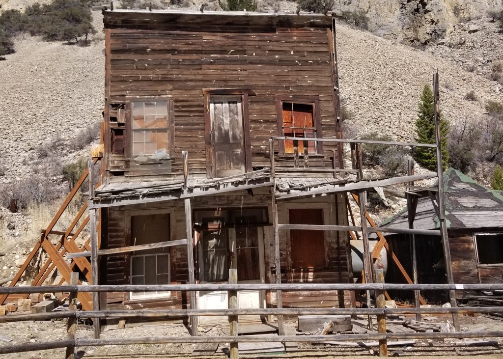
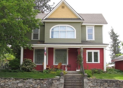
Built Environment

  1. Submit at least two (2) clear current .jpg format photographs per resource. Primary photos should not be taken from other websites or sources (Google Earth, Bing, County Assessor records, etc.). Additional photographs may be necessary. In the photo description field include the subject, direction, and date.
  2. Attach a sketch map of the resource boundary that includes a north arrow; locations of buildings, structures, landscape features indicating contributing and non-contributing status; and a key. A sketch map is required for more than two resources  on a property (e.g. house, garage, chicken coop). Please review the complex resource section for additional guidance.  
  3. Built environment records may be supplemented by resource-specific documentation such as historic photographs, sketches, architectural or engineering drawings, historical documents, news clippings, and other miscellaneous materials.
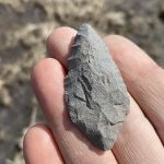
Isolated Finds

An “isolated find” is an archaeological category of artifacts that lack data potential and/or context to produce further data. The definition of an isolate can vary by region, context, and professional judgement; if another definition is not already in use, the Idaho SHPO defines an isolate as fewer than 10 artifacts in a 10m x 10m area. Additionally, isolates should only be recorded for artifacts over 45 years of age. If using a different definition, the definition should be clearly stated in the report and be consistent across all isolates within a given project. In general, isolated finds are locations exhibiting brief episodes of activity with a lack of artifact density and diversity. An isolated artifact accompanied by a feature warrants recordation as a site.

Finds with potential subsurface deposits should not be recorded as isolates. Strongly consider the environmental context when determining the likelihood of subsurface deposits. The recorder must demonstrate that the entity is an “isolate” through full description of the items, environmental context, and event or activity as interpreted during recordation. Adequate justification must be given and a statement of non-significance should be provided on the isolate table in the SHPO Report Template. In addition to the table, in ICRIS, upload a shapefile (zipped) of isolate locations under “Project Attachments.” Because isolates, by definition, lack data potential and/or context to produce further data, they are considered not eligible for listing on the NRHP.

Isolated find (type/description)


Location


Photo


1. Hole in top can


11N 564828E

 4829142N


2. Projectile point

11N 564830E 4829150N


Districts and Complex Resources

When recording a complex of buildings and/or structures, the resource must include references to and brief descriptions of all existing buildings, structures, objects, and features on the property. An example of a complex of buildings is a small farmstead. Larger complexes or groupings of buildings must be recorded as an historic district.

  • Any group of buildings such as large farmsteads, school or university campuses, hydroelectric projects, airports, Forest Service administration sites, recreation residence tracts, residential or commercial neighborhoods, etc. must be recorded as a district.
  • Each building within the district will need its own resource record that discusses its individual eligibility, as well as its contributing status within a district.
  • Small farmsteads (e.g. a house, barn, and chicken coop) must be recorded as a building and the boundary should delineate the extent of the farmstead. Record the primary building. Any potentially individually eligible buildings or structures must receive their own resource record (e.g., barn, grain elevator, and canal).
  • If there is an area that has the same temporal or related resources and includes archaeology and built environment resources, record as district e.g. mining district such as Bayhorse.
  • If there is no relationship between an archaeological site (e.g., precontact) and historic buildings or structures, do not lump them onto one archaeological resource record (e.g. campground and a precontact site would be recorded as two separate resources).

Linear Resources

As part of the development of the ICRIS at SHPO, engineering and historic linear properties have been divided into ten (10) types or categories: roads, railroads, agricultural water, timber, mining, livestock, emigrant trails, trails, and others.

  1. Roads: Roads are those that appear on any modern map from city streets to interstate highways. It also includes roads, numbered or not, identified on U.S. Forest Service maps.
  2. Railroads: Railroads include all common-carrier railroads and railroad grades or those that generally transport passengers or goods/cargo. If a railroad or rail system exists solely for the purpose of transporting timber or mining products, it should be categorized as Timber or Mining.
  3. Irrigation Resources: Irrigation resources are those that are associated with the development of water conveyance for agricultural purposes.
    1. Only primary laterals that divert directly from the canals (these typically have a name or number), and regulated drainage systems require recordation and evaluation. Resources below that level, such as tertiary laterals or ditches are not required to be recorded and are considered ineligible. There are always exceptions. Ditches associated with mining sites or homestead sites would be considered a feature of a larger site and would therefore require recordation as such.
  4. Timber: Roads, railroads, flumes, and chutes associated with logging and the timber industry.
  5. Mining: Roads, railroads, and ditches associated with the mining industry.
  6. Livestock: Historic drivelines for cattle and sheep
  7. Trails: Pre-Colonial or historic trails
  8. Emigrant Trails: historic emigration routes such as the Oregon Trail
  9. Others: Other linear resources can include such aboveground structures as transmission lines, telephone lines, fences, levees/embankments, and aerial tramways (excluding mining features), to name a few.

The following requirements are intended to collect sufficient documentation of linear resources in order to appropriately evaluate their historical significance.

  • A general, physical description of linear resource itself; include the approximate length of the resource in its entirety, materials, setting and environment, etc.
  • A brief history of the resource. When possible, include such information as significant dates, significant persons, associated resources (canal systems, laterals, mining sites, railroad camps, etc.)
  • Photographs depicting overviews of the linear resource from various locations within the recorded area
  • At least one (1) photograph of each of the major features along the resource within the recorded area, such as bridge crossings, retaining walls, diversion structures, head gates, drop structures, weirs, etc.
  • Map the entire route of the resource, county line to county line. If you are not importing the mapped resource from a GIS layer, portions of the route may be based on historic documents, general knowledge, system maps, or even assumption. If you are importing the resource from a GIS layer, please import the entire length of the resource as it will improve future ICRIS searches for all users. Comprehensive field examination for the full extent of the resource is not required.

Updating Linear Resources in ICRIS

To learn how to update a linear resource in ICRIS view our training video. The linear resource record in ICRIS is meant to represent the overall resource. You will need to complete a linear segment form  for the portion of the linear resource within your project area. 
  • Updating eligibility: only change the overall eligibility for the resource on the main resource page if the entire linear resource eligibility has changed
  • Updating features: account for the features within your project area. If the current record has 3 features ( 2 headgates, siphon) and you have a drop structure and headgate in your project area, change the record to reflect 5 features (3 headgates, siphon, drop structure). 
  • Mapping in ICRIS:
    • For updating an existing linear resources, zoom into the section of the resource within your project area, if the location has changed is or incorrect, correct the route of the linear resource. We recommend using a imagery base layer to confirm its location.  
  • Photos: Upload photographs to the overall resource page.
  • Segment form:
    • Complete linear segment form for the segment within your project area.
    • Include a map of the section of resource within your project area.  
    • Save segment form as PDF and upload under “Resource Attachments.”

Exempted Resources

Some resources may be exempted from recordation. These resources may be ones that were exempted through an ACHP Program Comment, SHPO policy, or due to age. REVIEW SHPO EXEMPTED RESOURCE POLICY PAPERS HERE. Using the table in the report template supply the research to prove the exemption, i.e., concrete culvert was built in 1952 according to highway district plans; two-track road did not appear on a map prior to the 1965 USGS 1:24,000 scale topographic map (two-track road policy coming soon).

Exempted Resource (Name, location)

Exemption (Post 1945 Bridge Program Comment, Idaho Irrigation Policy, Idaho Two-track Road Policy, etc.)

Research (historic documentation reviewed to prove exemption)

1.   The NY Canal Bridge, W. Roosevelt Rd and Targee St., Boise

1945 Bridge exemption

Concrete bridge built in 1957 

2.     Unnamed lateral

ID Irrigation Policy

Lateral is a fourth tier lateral off the NY Canal

3.  1451 Main St. – Commercial Building

Age

Built in 1990

GENERAL PHOTO STANDARDS

Please keep in mind that the photographs submitted to the Idaho SHPO as documentation for resources are meant to assist SHPO staff in determining eligibility and effects; take photographs accordingly. While the minimum requirement is two photos, documentation should be sufficient to allow for a thorough understanding of the resource, sometimes this means more than two photographs. Inadequate photo documentation or photos that do not meet the following requirements will result in a request for new/better photos and will likely delay SHPO Review.

At least two (2) clear .jpg format photographs per resource must be submitted for each site. Photos should be original current photographs. Primary photos should not be taken from other websites or sources (Google Earth, Bing, County Assessor records, etc.)

In the photo description field, include the subject, direction, and date. Appropriate resolution and contrast are of utmost importance for report reviewers to be able to appropriately understand and evaluate the property.

Archaeological Resources

  • Photographs that allow reviewer to understand the site and its geographic/environmental context. These must include geographic features that would help relocate the site, photographs of significant features, concentrations, or artifacts.
  • Photographs of representative examples of diagnostic artifacts recovered from archaeological sites should be included. Artifact photos should have the appropriate scale included. Metric measurements are standard, although historic artifacts may be measured using the English standard.
  • Excavation photos must include a legend, scale, north arrow, and photo board containing site number, unit, depth, date, and company/photographer.

Built Environment Resources

  • Every built environment resource must be illustrated with a minimum of two (2) clear unobstructed photographs. In circumstances where the integrity of setting and location are relevant to a determination of eligibility, include photographs from far enough away that the entire site, as well as the setting, are visible.
  • When photographing historic buildings, photograph the primary (front) exterior wall of each property recorded; oblique images, where possible, are recommended and requested to help properly evaluate the property.
  • Where a property has multiple buildings or structures, provide photographs of each feature. Photographs of significant architectural elements must be submitted.
  • Depending upon the complexity of a property, it may be necessary to take several photographs from various angles as well as of major additions and/or alterations, features, or architectural details.

EVALUATE HISTORIC SIGNIFICANCE

Any resources or cultural materials, whether previously identified or newly identified within the area of potential effect must be evaluated for their historic significance in order to determine project effect. This is completed by applying the criteria for the National Register of Historic Places (36 CFR 63). The criteria are developed and overseen by the National Park Service (NPS). The NPS has provided detailed guidance for assessing significance (eligibility for the National Register) in HOW TO APPLY THE NATIONAL REGISTER CRITERIA FOR EVALUATION (formerly National Register Bulletin 15) and GUIDELINES FOR EVALUATING AND REGISTERING ARCHAEOLOGICAL PROPERTIES (formerly National Register Bulletin 36).

SHPO requires that the Federal agency follow this guidance when evaluating historic significance. There are three (3) general required provisions: context, criteria, and integrity.

CONTEXT

The first step in determining whether or not a cultural property is a historic property (eligible for listing in the National Register of Historic Places) is made in regards to context. For the purposes of determining eligibility, a “context” is a body of knowledge that is defined by a specific theme or topic, a specific geographical area, and a specific time period. All contexts and context studies are resource based – that is, they must relate to identifiable cultural resources. Contexts serve as frameworks for evaluating the National Register eligibility of cultural properties. Idaho has a number of NATIONAL REGISTER MULTIPLE PROPERTY DOCUMENTS that are helpful in determining the context of a particular site. 

THE SIGNIFICANCE OF A HISTORIC PROPERTY CAN BE JUDGED AND EXPLAINED ONLY WHEN IT IS EVALUATED WITHIN ITS HISTORIC CONTEXT.

NATIONAL REGISTER CRITERIA

After evaluating context, a cultural property must also be shown to be significant for one or more of the four criteria in order to be considered a historic property:

A) Associated with events that have made a significant contribution to the broad patterns of our history

To be considered for listing under Criterion A, a property must be associated with one or more events important in the defined historic context. Criterion A recognizes properties associated with single events, such as the founding of a town, or with a pattern of events, repeated activities, or historic trends, such as the gradual rise of a port city’s prominence in trade and commerce. The event or trends, however, must clearly be important within the associated context: settlement, in the case of the town, or development of a maritime economy, in the case of the port city. Moreover, the property must have an important association with the event or historic trends, and it must retain historic integrity.

B) Associated with the lives of persons significant in our past

Criterion B applies to properties associated with individuals whose specific contributions to history can be identified and documented. Persons “significant in our past” refers to individuals whose activities are demonstrably important within a local, state, or national historic context. The criterion is generally restricted to those properties that illustrate (rather than commemorate) a person’s important achievements.

C) Embodies the distinctive characteristics of a type, period, or method of construction, or that represent the work of a master, or that possess high artistic values, or that represent a significant and distinguishable entity whose components may lack individual distinction

This criterion applies to properties significant for their physical design or construction, including such elements as architecture, landscape architecture, engineering, and artwork. To be eligible under Criterion C, a property must meet at least one of the following requirements:

  • Embody distinctive characteristics of a type, period, or method of construction.
  • Represent the work of a master.
  • Possess high artistic value.
  • Represent a significant and distinguishable entity whose components may lack individual distinction.

D) Have yielded, or may be likely to yield, information important in prehistory or history

Certain important research questions about human history can only be answered by the actual physical material of cultural resources. Criterion D encompasses the properties that have the potential to answer, in whole or in part, those types of research questions. The most common type of property nominated under this Criterion is the archeological site (or a district comprised of archeological sites). Buildings, objects, and structures (or districts comprised of these property types), however, can also be eligible for their information potential.

Criterion D has two requirements, which must both be met for a property to qualify:

  • The property must have, or have had, information to contribute to our understanding of human history or prehistory, and
  • The information must be considered important.


CRITERIA CONSIDERATIONS

As a general rule, certain classes of properties are considered to be not eligible for the National Register of Historic Places; however, there are exceptions to these rules, called Criteria Considerations. These classes of properties and their exceptions are:

a.) Religious properties:  Can be eligible if they derive their significance from their architectural or historical significance, or are part of a larger historic district.

b.) Moved Properties:  Can be eligible if their significance is primarily architectural or if the location to which it is moved provides a similar context and setting as the location from which it has been removed.

c.)  Birthplaces or Graves:  Can be eligible if the person is of outstanding importance and there is no other extant property associated with their productive life.

d.) Cemeteries:  Can be eligible if they have distinctive design features, or are associated with specific important historic events.

e.) Reconstructed Properties:  Can be eligible only if it is accurately executed and presented as part of a restoration master plan and when no other building or structure with the same associations has survived. All 3 of these requirements must be met.

f). Commemorative Properties:  Can be eligible if its design, age, tradition or symbolic value has its own historic significance.

g.) Properties Less than 50 Years Old:  Can be eligible if it is of exceptional importance, or, if, as a class, the property is considered fragile or disappearing.

See NRHP Bulletin HOW TO APPLY THE NATIONAL REGISTER CRITERIA FOR EVALUATION for more information and detail regarding Criteria Considerations.

INTEGRITY

Finally, in addition to context and the four criteria, a cultural property’s integrity must also be evaluated. Integrity is the ability of a property to convey its significance. It is important to note that “integrity” is different than “condition.” A property can be in poor condition, but still effectively convey its significance, meaning that it would still have a high level of integrity.

Conversely, a property can be in excellent condition, but has been so altered over time that it has lost all integrity because it no longer reflects the essential, character-defining features of that style or property type.

The NPS has identified seven aspects of integrity which include: location, design, setting, materials, workmanship, feeling, and association. Each property should be evaluated with these aspects in mind. Depending on the type of property, different aspects of integrity may have more relevance, so each property should be evaluated with that in mind.

LOCATION

Location is the place where the historic property was constructed or the place where the historic event took place. Integrity of location refers to whether the property has been moved or relocated since its construction. A moved property can be considered to have integrity of location if it was moved before or during its period of significance

DESIGN

Design is the composition of elements that constitute the form, plan, space, structure, and style of a property, but recognizing that properties can change through time and do not always constitute a loss of integrity of design.

SETTING

Setting is the physical environment of a historic property that illustrates the character of the place. Integrity of setting remains when the surroundings of a property have not been subjected to radical change.

MATERIALS

Materials are the physical elements combined in a particular pattern or configuration to form a historic property. Integrity of materials determines whether or not an authentic historic resource still exists.

WORKMANSHIP

Workmanship is the physical evidence of the crafts of a particular culture or people during any given period of history. Workmanship is important because it can furnish evidence of the technology of the craft, illustrate the aesthetic principles of a historic period, and reveal individual, local, regional, or national applications of both technological practices and aesthetic principles.

FEELING

Feeling is the quality that a historic property has in evoking the aesthetic or historic sense of a past period of time. Although it is itself intangible, feeling is dependent upon a property’s significant physical characteristics that convey its historic qualities.

ASSOCIATION

Association is the direct link between a property and the event or person for which the property is significant. A period appearance or setting for a historic property is desirable. Integrity of setting, location, design, workmanship, materials, and feeling combine to convey integrity of association.

See NRHP Bulletin HOW TO APPLY THE NATIONAL REGISTER CRITERIA FOR EVALUATION for more information and detail regarding the seven aspects of integrity.


Integrity v. Condition

Poor Condition - Good Integrity

Bayhorse Hotel

Although in poor condition, this building at Bayhorse State Park is immediately recognizable for what it was as a boomtown hotel building, identifiable by the false-front design and the exterior door on the second story. Siding and windows, while in a state of disrepair, are all original materials and accurately convey the building’s era as late 19th century. This building is listed in the NRHP.

Good Condition - Poor Integrity

Rathdrum House

This home is clearly in good condition and was built during the territorial period of Idaho’s history; however, a number of features make it difficult for the casual viewer to properly place its construction in the 1880s. The oversized window on the second story, enclosure of a portion of the front porch (with modern, paired windows), the lack of balustrade on the remaining porch, and loss of prominent, visible entry, all degrade the house’s integrity and render it not eligible for the NRHP.

ARCHAEOLOGICAL SITE INTEGRITY

Archaeological site integrity is often determined under Criterion (D), the potential of the site to yield information important in history or precontact history. This involves, first, determining through an appropriate review of the background literature, whether the site could yield information important in resolving research questions; and second, determining how intact the deposit is relative to its information potential. Intact deposits are those that remain relatively undisturbed relative to their past history. This depends on the context in which artifacts, features, and other traces of past human activity are found, and the associations among these traces. The archaeologist must determine whether what she finds was found where it was originally deposited, and whether the things she finds are credibly associated with one another. If they meet both conditions, the deposits are intact enough to address a significant research question.

ASSESS ARCHAEOLOGICAL SITE SIGNIFICANCE

Three general contexts are appropriate for archaeological and traditional cultural properties:

  1. Precontact archaeology
  2. Historical archaeology
  3. Ethnic/Native American Traditions

Data from Idaho’s precontact and historic archaeological deposits and ruins have not been synthesized. In many regions of the state, either a chronology has not been developed or it has not reached common acceptance. Only very limited literature reviews and interviews have been conducted with contemporary ethnic and Native American populations that address traditional cultural properties.

Therefore, each archaeological site/ruin will be considered eligible to the National Register until it is demonstrated that no information remains to be gleaned from its deposits or surface features. A potential traditional use location will be regarded as eligible until its significance is invalidated through interviews with appropriate traditional communities.

Finally, isolated finds will be considered ineligible if there is no evidence of possible associated subsurface materials. Adequate justification must be given and a statement of non-significance should be provided on the isolate table within the survey report. In ICRIS, each project with isolated finds must upload a shapefile of the isolated finds to the project attachments section. 

For Section 106-related surveys, evaluation is a crucial step in the 106 Review process and needs to be well documented. Cultural properties recorded during general archaeological research must be evaluated (eligible or not eligible) to be added to Idaho’s state inventory.

TRADITIONAL CULTURAL PROPERTY (TCP) EVALUATION

A traditional cultural property (TCP) is a property that is significant because of its association with cultural practices or beliefs of a living community that are rooted in that community’s history and are important in maintaining the cultural identity of the community. To be considered in the Section 106 Review process, a TCP must be listed or eligible for listing in the National Register of Historic Places.

To be eligible for listing in the National Register of Historic Places (NRHP), a traditional cultural property must:

  • Be a tangible place. The NRHP does not list cultural practices or beliefs. Tangible means that you must be able to physically locate a property. It does not mean that you have to have physical, man-made features or items at the place. A mountain, a street corner, and a pueblo are all tangible places.

  • Be important to the community today and play the same role in the community’s traditions as it did in the past.

  • Have been important for at least 50 years. For example, a place where pow-wows are held now, but were not held 25 years ago, probably does not meet the 50-year rule. The use of the property, however, does not have to be continuous over the last 50 years, but there should be a pattern of use or continued value.

  • Have integrity. By regulation, integrity means integrity of location, design, setting, materials, workmanship, feeling, and association. The importance of each of these elements varies depending on the nature of the property. For TCPs, integrity can often be evaluated in terms of the strength of the property’s association with the traditions of the community and the property’s condition. The association between the place and the community’s traditions must be strong. For example, if the traditional activity can be carried out anywhere, then there is no link between the activity and the place (ritual bathing – in any stream or just in a particular spring; fishing – any local source or a specific hole or spot associated with a deity or spirit; hunting – any natural area where game is available or particular sacred hunting ground). Every year since 1832, the Seneca and Cayuga Indians have conducted specific ceremonies at what is now the Basset Grove Ceremonial Grounds in Oklahoma. This property definitely has integrity of association and location. The property’s condition is just as important to consider. If commercial buildings surround a TCP that should have a pristine natural environment, then the property has little integrity of condition. Integrity of condition, however, should be evaluated from the perspective of those who value or use the property. For example, a New Mexico Hispanic community has conducted traditional dances in a specific area since the early 1900s. The three-acre dance site now includes a bar, community center, and parking lot. Nevertheless, the ongoing use of the site in much the same manner as has been conducted for over the last 80 years demonstrates that the dance site still has integrity of condition for that particular tradition. If the changes had somehow forced the termination of dances there, or their relocation, the integrity of condition would be lacking, despite the fact that the Hispanic community might still regard the old site as a special location.

  • Have definable boundaries. Establishing boundaries can be problematic. In many cases, the idea that there is a “real” boundary is absurd. Nevertheless, a TCP listed in the NRHP must have definable, or at least defensible, boundaries. Geological or natural formation traditional cultural properties can also often be problematic because it can be difficult to establish where a formation begins or ends. For example, the top of a mountain is usually obvious, but where is the bottom? Knowledgeable members of the traditional community should be consulted for guidance about what criteria are important in deciding where, for example, a mountain begins or ends. Their comments should be supported by oral tradition, ethnographic evidence, or physical evidence. Perhaps the answer lies in what constitutes a mountain, or a significant place, not where does it begin and end. Is the river at the mountain’s base part of the mountain or is the river its own entity distinct from the mountain? The answers will vary by community.

  • Have defensible boundaries. Defensible boundaries should be based on the characteristics of the property, how it is used, and why it is important. These characteristics must be clearly articulated in the documentation.

  • Meet NR Criteria. Like any other property, to be listed in, or eligible for listing in, the NRNP, a TCP must meet one or more of the NRHP criteria. TCPs do not have criteria all of their own. TCPs are almost always listed under Criterion A (and sometimes B) for their association with historical events or broad patterns of events.

Not all TCPs are eligible for the NRHP.

DETERMINING EFFECTS

One of the important roles of the SHPO is to assist in determining effect and plans to avoid, minimize, and mitigatee potentially harmful impacts to historic properties within Idaho. Once the APE is defined, potential historic properties are identified, and their eligibility for listing in the National Register is understood, the ID SHPO may provide comments on how any proposed actions may affect historic properties.

Both the ID SHPO and Federal regulations acknowledge that effects to historic properties can vary widely. The regulations define an adverse effect as when activities:

“…may alter, directly, or indirectly, any of the characteristics of a historic property that qualify the property for inclusion in the National Register in a manner that would diminish the integrity of the properties location, design, setting, materials, workmanship, feeling, or association” [36 CFR 800.5(a)(1)].

The assessment of effects relies on a robust understanding of the proposed activities and a historic property’s National Register eligibility determination and integrity. In instances where site eligibility is unknown, site records are incomplete, or recorders were unable to determine eligibility, the ID SHPO will treat the site as eligible for listing in the NRHP and evaluate effects accordingly.

TYPES OF EFFECTS

Because effects can vary widely, Federal Regulations (36 CFR 800) divide effect into three main categories: direct, indirect, and cumulative.

Direct Effects

Federal regulations state that direct effects are “caused by the action and occur at the same time and place.”[1] Direct effects are typically well understood and predictable with a causal relationship to the undertaking activities. Importantly, these effects are not limited to immediate effects but includes all effects which are caused by an undertaking whether the causes are immediate, reasonably foreseeable, or further removed in time. Examples of direct effects include demolition, physical destruction, alteration, removal, excavation, grading, and disturbance as well as neglect that results in deterioration and transfer, sale, or lease of a property outside of public control. Because direct effects are determined based on causality, they are not limited to physical effects but also may include visual, auditory, or other effects that are reasonably foreseeable but may be later in time or farther removed in distance as well.[2]

Indirect Effects

An indirect effect is an effect which is caused by the undertaking but may not be directly related to the activities. Indirect effects may be either permanent or temporary in nature and, in the context of a Section 106 review, it is useful to identify the anticipated duration of any indirect effects. Examples of indirect effects may include additional development or urbanization around a newly constructed reservoir or increased vandalism to archaeological sites due to road expansions making it easier to access areas.

Cumulative Effects

A cumulative effect results “from the incremental impact of the action when added to other past, present, and reasonably foreseeable future actions regardless of what agency (Federal or non-Federal) or person undertakes such other actions. Cumulative impacts can result from individually minor but collectively significant actions taking place over a period of time.”[3] An example of cumulative effects may include the incremental loss in integrity resulting from the burial of multiple segments of a canal across the span of several  unrelated projects. While none of the individual projects may have resulted in an adverse effect, in aggregate, the multiple projects may render the canal ineligible.

NATURE OF EFFECTS

The regulations provide three categories to characterize how an undertaking may affect historic properties (termed effect findings): no historic properties affected, no adverse effect, and adverse effect. An effect finding is determined based on understanding the sites within the APE, the project activities, and the types of effect(s) which will occur. It is the responsibility of the submitting federal agency  to propose an effect finding. In their response, ID SHPO will either provide concurrence (agreement) on the agency’s finding or will request additional information. The ID SHPO does not determine the effect an undertaking will have on historic properties, instead their role is to assess whether the documentation submitted supports the agency’s conclusion or seek clarification if necessary.

No Historic Properties Affected

If there are either no historic properties present within the APE or there are historic properties present but they will be unaffected by the undertaking, the proposed activities may be considered to have no affect to historic properties[4].

No Adverse Effect

If historic properties are present but the undertaking activities are designed, modified, or conditioned to avoid adverse effects to National Register characteristics, the proposed undertaking may be considered to have no adverse effect to historic properties[5].

Adverse Effect

As stated above, an adverse effect occurs when an action alters National Register characteristics or compromises the integrity of a historic property. If adverse effects are identified, the ID SHPO works with project proponents and government agencies to avoid, minimize, or appropriately mitigate adverse effects.

RESOLUTION OF ADVERSE EFFECTS

If adverse effects are identified, the ID SHPO works with project proponents, agencies, interested parties,  tribal partners, and others to avoid, minimize, and mitigate effects. This is called resolution.[6]

Resolution can be achieved through a variety of means and often involves signing a Memorandum of Agreement (MOA) or Programmatic Agreement (PA). MOAs and PAs are legal documents which detail  how an undertaking will resolve adverse effects. Examples of resolution may include excavation and recordation of an archaeological site, preservation of certain aspects of a historic building, survey, or completion of a National Register Nomination. The SHPO’s role in the resolution process is to advocate for both Idaho’s historic properties and the citizens of Idaho. For more ideas and information please visit our website at  Mitigation Process.

[1] 40 CFR 1508.8

[2] 2019 ACHP Memo and NPCA v Semonite

[3] 40 CFR 1508.7.

[4] 36 CFR 800.4(d)(1)

[5] 36 CFR 800.5(b)(1)

[6] 36 CFR 800.6

ARCHAEOLOGICAL TESTING & ARTIFACT COLLECTION

STATE ANTIQUITIES PERMIT

The State Archaeologist must be contacted about obtaining a State permit only if excavation (including shovel testing, auguring, or formal testing) is anticipated on State land (State Code § 67-4120). Permits shall be issued only to applicants who are qualified by experience or professional training to conduct such excavations in an approved scientific manner.

If working on Federal land, Federal agencies should be contacted about obtaining a Cultural Resource Use Permit. Persons or organizations proposing to undertake archaeological or vertebrate paleontological excavations within lands owned by the State of Idaho shall, in accordance with the provision of Chapter 181, Idaho Sessions Laws, 1963, approved March 19, 1963, apply in writing to the trustees of the Idaho State Historical Society (ISHS) for a permit. Applications should be sent via electronic mail to shsshpo@ishs.idaho.gov.

Before application is made, permission from the Idaho State Land Board shall have been obtained for excavation of Idaho state lands, and a copy of such permission shall be included with the application for a permit.

The letter of application for a permit shall include:

  1. A description accompanied by a detailed map of the precise location of the proposed excavation. Township, Range, and Section must be included.
  2. A general description of the archaeological or paleontological site, including an indication of its size.
  3. Name of the individual to be in immediate charge of the excavation, together with their professional qualifications.
  4. General extent of the excavation proposed, expected date of beginning, and anticipated time needed to complete work.
  5. A Curation Agreement between the appropriate state agency and the designated regional curation facility for the disposition of artifacts and specimens recovered .
  6. Information concerning possible scholarly publications of the findings.

Permits shall be granted for a definite period of time, but shall be terminable at the discretion of the ISHS trustees. Failure to begin the work outlined within a reasonable length of time or to continue such work with reasonable diligence may result in cancellation of the permit.

Two copies of the permit shall be furnished to successful applicants, and one copy shall be kept at the excavation site. The site may be inspected by trustees or advisory committee members or their designated representatives.

Upon completion of the excavation or field season, the ground is to be returned to a safe and sightly condition. In particular, all excavations are to be filled.

Annual reports on the progress of work done must be submitted to the ISHS by February 1 of each year. They shall be accompanied by photographs sufficient to give a general conception of the undertaking.

At the completion of the investigation, a final report is required. Permit holders shall also provide copies of any other scholarly publication concerning the work for which permit was granted.

The permit holders shall notify the ISHS when transfer of the artifacts, specimens, and other objects recovered in the course of excavation has been completed.

Excavation / Testing during survey

Two principle types of testing may occur during archaeological survey. The more common is to conduct a series of Shovel Probes (SP) or Shovel Test Pits (STP) during the survey in areas of concern or where surface visibility is poor due to dense vegetation or soil capping. The goal at this level is to identify if resources are present in locations which ordinarily would be regarded as having a medium to high potential for archaeological materials. The quantity and placement of SPs and/or STPs is at the discretion of the Principal Investigator but should be sufficient in number to adequately address the potential or concern. Testing strategy should be defined within the survey report and conform to professional standards, requirements of applicable land managing agencies, and determined in consultation..

A second type utilizing SPs or STPs during archaeological survey may be in the vicinity of a known archaeological site. In this method, a SP or STP may be incorporated into the survey if attempting to confirm the presence/absence of subsurface material near a potential site boundary. The intent is not to evaluate the site, but to confirm the presence or absence in the identified location. Any SP or STP yielding cultural material would be immediately halted, documented, and backfilled.

All decisions to test or not to test should be justified in the documentation. SPs and STPs will typically be 30-40 cm in diameter and not less than 60 cm in depth. Levels will be excavated in 10 cm intervals and screened through 1/8-inch hardware cloth over a tarp. Each SP or STP will be recorded with a sub-meter accurate GPS and the results, including coordinates, provided in the inventory report.

Excavation / Testing during evaluation

During site evaluation, several common types of archaeological testing procedures may be applied. The more common is to conduct a series of Shovel Probes (SP) or Shovel Test Pits (STP) during the survey in areas of concern where visibility is poor (see above). Testing or Excavation may also be conducted. Where excavation or testing occurs, sediments should be screened through 1/8-inch mesh and referenced to a site datum located on the site plan map and on the USGS site location map. Investigators must check with property owners and land managing agencies prior to inventory. There are also cases where formal 1×1 m or 50 x 50cm test units are more appropriate than shovel probes during inventory. However, formal test units will usually take place during Eligibility evaluations, after the SHPO and other consulting parties have had a chance to comment on a testing design plan.

Formal testing and data recovery should always utilize 1/8 – inch mesh screen. The use of 1/4 – inch mesh results in data loss, particularly with faunal remains.

Collection

Generally, surface artifacts should only be collected in order to aid in the evaluation of a site’s eligibility for the National Register and should always be done in accordance with approved collections standards and guidelines. One exception to this guidance might be the collection of rare or unusual artifacts such as a Clovis projectile point; however, each agency should have a written procedure in place for specifying the types of artifacts (e.g., artifacts of extreme age or rare artifact class) and conditions (e.g., imminent loss of artifacts due to threats from looting, erosion, etc.) that qualify for this exception.

If the Agency decides that artifacts are going to be collected during survey in order to facilitate National Register eligibility determinations, then the Agency should develop written guidelines specifying standards for collection. The Agency’s guidance should clearly define what factors foster the decision to conduct surface collection during survey. These written guidelines should be provided to archaeological consultants performing cultural resources inventories.

ver: 3.5.2 | last updated: