
Submit a Project in ICRIS
Use the Idaho Cultural Resource Information System (ICRIS) to initiate consultation with the Idaho State Historic Preservation Office (SHPO) for Section 106 projects, or to submit Section 110 reviews, Annual Reports, Certified Local Government surveys, or determinations of eligibility. If any part of the project is located within the boundaries of the Nez Perce or Coeur d’Alene Indian Reservations, you must contact the Tribal Historic Preservation Officer (THPO) to initiate separate consultation with the Tribes, as well.
Contact
(208) 334-3861
Section 106 Projects
In ICRIS:
- Select ’Create-New Project’
- Select ‘Section 106’ from project-type dropdown.
- Fill out required fields
- Map the project location by uploading a shapefile or drawing it in the GIS
- Create new, or update existing, resource records for resources within the project area
- Upload PDF-format survey report (which is written outside the ICRIS)
- Upload project overview photographs (minimum of two jpg photographs are required)
LITERATURE REVIEW (FORMERLY RECORD SEARCH)
In ICRIS, users will perform their own literature review, rather than requesting the information from the SHPO.
Cover Letter
Submit a cover letter or agency-approved form (e.g. US Department of Housing and Urban Development’s DoSE, Forest Service’s DSE, Idaho Transportation Department’s 1502) in PDF format with the following information:
- Name and contact information of Federal agency or agencies involved.
- Project description that clearly specifies all project components including details on:
- Work that will affect the physical characteristics of buildings and structures more than 45 years old and their sites. For example, will windows be replaced? If so, describe the existing windows and the proposed replacement units. Will an addition be constructed onto the building? Where will it be located, and what will it look like? Will the building’s setting be affected? Will the historic landscape be affected?
- Work that will involve ground disturbance. For example, if the project will be replacing water lines or sewer lines, will the new lines be placed in the same trench or will it be new construction? Will other areas be used, such as staging areas, borrow sources, or disposal areas?
- Description of Project Area:
- Brief description of the condition of the ground surface or any information relating to past construction or heavy equipment work within the project area. Has the area been bulldozed? Is it paved or covered with lawn or dense vegetation? Were there structures located on the property in the past? To investigate, you can consult county assessor records, Sanborn fire insurance maps, owners or previous owners, or long-time citizens.
- Describe all buildings, structures, or objects that will be involved, altered, or removed during project construction.
- Historic Properties in Project Area:
- Provide information on any historic properties or cultural resources known to exist in the immediate area surrounding the project. Reference your literature review results in ICRIS for previously recorded resources.
- Summary of previous Section 106 Review(s) of the project, or an earlier project in the same area including dates of correspondence and project finding.
- Provide a summary of any consultation with interested parties or tribes.
- Provide final effect determination for Section 106 undertakings.
Photos
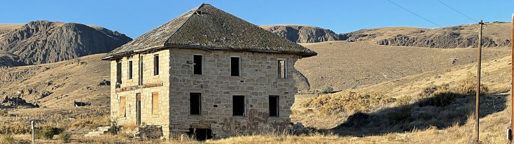
In ICRIS within your Project, upload a minimum of two project-area overview photographs (JPG format) for Section 106 projects. These photos are for SHPO staff—who, have likely not been to the project area—to better understand the project setting and location. While only two photos are required, please use professional judgement to determine whether more photos will be necessary for SHPO reviewers to adequately understand the physical context of the project. Cell tower and wind farm projects will likely require additional photos to capture views to and from the proposed tower location(s). Photographs should be current, original, and not taken from Assessor records, screenshots, Google Earth, etc.
Supplemental Attachments (as applicable)
On your project page in ICRIS, upload any supplemental attachments:
- Legible architectural plans, drawings, and elevations, as necessary, to describe the project.
- Any correspondence with tribes, city, or county governments, historic preservation commissions, historical societies, Certified Local Governments (CLGs), or other consulting parties.
GIS (Mapping)
After creating the project, scroll down to the GIS map to define the project location(s). ICRIS allows you to draw or upload a shapefile of the area of potential effects (APE). Standard literature review buffers (formerly referred to as a ‘record search’) will default to 1-mile. Linear projects may use a ½-mile buffer. Buffers can be adjusted in ICRIS. If you aren’t sure what an appropriate buffer is for your project, contact your SHPO reviewer to discuss.
Survey Report
Write your report outside of the ICRIS and save it as a PDF (Download the SHPO Report Template)
After creating the project:
- Scroll to ‘Project Surveys’
- Select ‘New Survey’
- Fill out required fields
- Upload a PDF of the survey report.
- Add survey polygons in the GIS (upload a shapefile or draw new)
- Multiple survey polygons may be added for a survey report (e.g., separate Class III archaeological and Architectural survey areas)
- Select ’New Survey’ for each additional report.
To learn more about survey reports visit GUIDANCE FOR PREPARING SURVEY REPORTS SECTION.
Resources
Note: ICRIS uses the term ‘Resource’ rather than ‘Site’ for coding purposes. A resource can be a building, structure, object, historic or archaeological site, historic district, or linear property. To record a new resource, select ‘New Resource,’ or if a pro user, import from the Surveyor app using ‘Survey 123 Import.’ To update a previously recorded resource, click “Create New Version.”
Note: Resources previously recorded in other formats must be updated in ICRIS upon re-visitation or if the resource will be adversely affected by the project. After which, resources must be updated after 10 years or before if changes to a resource have occurred upon re-visitation.
To learn more about documenting resources see DOCUMENTING CULTRAL RESOURCES SECTION.
Per 36 CFR 800.3[c], upon receiving a complete project submittal via ICRIS, the SHPO 30-day review period begins.
Based on the nature of the project, the project’s location, and the information received, the SHPO will make one of the following comments:
No historic properties affected
Either archaeological and/or historical surveys have been conducted, and there are no historic properties located within the area of potential effects (APE); or
The APE has been surveyed, and historic properties have been recorded and evaluated for eligibility for the National Register of Historic Places. Although sites exist within or adjacent to the APE, the project will not affect them; or
Considering the nature of the project and the project’s location, it is unlikely that the project will affect historic properties (e.g., National Endowment for the Arts or Humanities grants to produce stage performances).
No adverse effect
Historic properties are located within the APE, however, effects to them will not adversely impact the characteristics that qualify the historic property for inclusion in the National Register.
Adverse effect
Historic properties will be adversely affected. The regulations define an adverse effect as when activities may alter, directly or indirectly, any of the characteristics of a historic property that qualify the property for inclusion in the National Register in a manner that would diminish the integrity of the properties location, design, setting, materials, workmanship, feeling, or association [36 CFR 800.5(a)(1)].
Further consultation will be required prior to project implementation. To learn more, see RESOLUTION OF ADVERSE EFFECTS.
Request for additional information
If the SHPO reviewer is unable to make a determination of eligibility or effect based on the submitted documentation, the submitter will receive an official ’return notification’ email from the Idaho SHPO detailing a request for additional information. This information will also be documented under the project events log. A project may be returned to the Federal Agency/submitter in ICRIS due to: insufficient information (e.g., need for more/better photographs in order to understand the resource, unrecorded resources in the project area, lack of clarity in project descriptions, etc.); or
SHPO request for survey. Considering the nature of the project and the project’s location, there is reason to believe that historic properties may be located within the area and could be affected by the project. The applicant (or federal agency if it is subcontracting the work) should hire an appropriately qualified professional archaeologist or architectural historian to survey the project area and identify and evaluate any historic properties (See Hiring a Preservation Consultant). This work must follow the Secretary of the Interior’s Standards for Archaeology and Historic Preservation, and the qualified professional conducting the work must meet the Secretary of Interior’s Professional Qualifications Standards. All submittals must meet IDAHO SHPO’s GUIDELINES.
For Section 106 projects, pursuant to 36 CFR § 800.3, the SHPO 30-day review period will reset upon receipt of sufficient information.
No comment
- The project does not require a review by our office.
- Project takes place on tribal reservation lands and requires a review by the THPO, rather than the SHPO, per 36 CFR Part 800.2(c)(a)). Currently in Idaho, only the Nez Perce Tribe and the Coeur d’Alene Tribe have THPOs
- If the SHPO does not respond in any way within the federally mandated 30-day response time, the project may proceed without further consultation.
By law, the SHPO has thirty (30) calendar days to comment at each step of the review process once the project has been received. If there is a request for additional information or study, the 30-day review period resets when the new information is received.
The SHPO maintains information, records, and reports in ICRIS, however, official project records are typically the responsibility of the federal agency or applicant which is undertaking a project.
Survey Section 110, or Determination of Eligibility Projects CLG
In ICRIS:
- Select ’Create-New Project,’
- Select CLG Survey, Section 110, or Determination of Eligibility from project type dropdown
- Fill out required fields
- Map the project location by uploading a shapefile or drawing it in the GIS
- Create new or update existing resource records for resources within the project area
- Upload PDF-format survey report (which is written outside the ICRIS)
- Upload project overview photographs (minimum of two jpg photographs are required)
- Upload required overview photograph.
- Upload PDF-format cover letter.
SHPO Review
Upon receiving a complete project submittal via ICRIS, the expected SHPO review time for CLG Surveys, Section 110 submissions, or Determinations of Eligibility is 60-days, although depending on workloads, this could fluctuate.
Cover Letter
Submit a cover letter or agency-approved form (e.g. BLM State Protocol Forms or Forest Service’s DSE) in PDF format, with the following information:
Name and contact information of federal agency or agencies involved
Project description that clearly specifies all project components including details on:
Why project was undertaken (e.g., Section 110 survey, CLG grant, etc.)
Description of the project
Survey methodology, if applicable
Total number of identified historic properties surveyed (e.g., 100 properties surveyed)
Final NRHP determinations of eligibility (e.g., 25 eligible properties; 75 not eligible properties)
Photos
In ICRIS, within your project, upload at least one overview photograph (JPG format) for CLG Surveys, Section 110, and Determination of Eligibility projects.
- Provide a minimum of one general overview photograph of the project area but include as many as necessary to adequately convey an understanding of the general survey environment.
GIS (Mapping)
After creating a project, scroll down to GIS map to define the project location(s).
Survey Report
Write your report outside of the ICRIS and save it as a PDF (Download the SHPO Report Template)
After creating the project:
- Scroll to ‘Project Surveys’
- Select ‘New Survey’
- Fill out required fields
- Upload a PDF of the survey report.
- Add survey polygons in the GIS (upload a shapefile or draw new)
- Multiple survey polygons may be added for a survey report (e.g., separate Class III archaeological and Architectural survey areas)
- Select ’New Survey’ for each additional report.
To learn more about survey reports visit GUIDANCE FOR PREPARING SURVEY REPORTS SECTION.
Resources
Note: ICRIS uses the term ‘Resource’ rather than ‘Site’ for coding purposes. A resource can be a building, structure, object, historic or archaeological site, historic district, or linear property.
After creating a project and mapping your project location, you can review the previously recorded resources by selecting ’literature review.’ To update a previously recorded resource, click ’Create New Version.’ Note, all resources in the project area will need to be updated in ICRIS upon revisitation. If you are recording a new resource, select ’New Resource,’ or pro users using the Survey 123 field app can import from the app using the ’Survey 123 Import’ function. To learn more about documenting resources see: DOCUMENTING CULTRAL RESOURCES SECTION.
Annual Reports
In ICRIS, select ’Create- New Project,’ select ‘Annual Report’ from project-type dropdown. Fill out required fields.
Note: We recommend that agencies create their Annual Report project in ICRIS at the beginning of the year, and populate it with relevant projects, shapefiles/polygons, and resource records, as projects are undertaken. These documents will not be visible in the ICRIS until the agency hits ‘Submit’ on the annual report to send it to SHPO at the end of the year. Prior to submitting to SHPO, the agency will be able to access and edit these reports, maps, and resource records.
SHPO Review
Upon receiving a complete project submittal via ICRIS, the expected SHPO review time for Annual Reports is 60-days, although this could fluctuate depending on workload.
Cover Letter
Submit a cover letter (pdf format) with the following information:
- Name and contact information of Federal agency or agencies involved
- Why the annual report is being submitted (e.g., requirement of a MOA, PA, etc.)
- Summary of annual report
- Proposed PA amendments, if applicable
Other Requirements
If any of the projects being reported on in the annual report required a survey report and/or resource records, follow the steps above to add them to ICRIS.