Illuminating Idaho Member Newsletter
Illuminating Idaho is the Idaho State Historical Society’s exclusive member newsletter, created just for history lovers like you. Each month, it shines a light on fascinating stories from Idaho’s past, highlights statewide historical happenings, and shares unique ways for members to get involved. It’s your inside connection to the people, places, and moments that continue to shape the Gem State.
Contact
(208) 334-2682
This Month's Illuminating Idaho
Revolutionary Mothers & Daughters
written by state historian hannalore hein
Every second Sunday in May, Americans pause to honor the women who raised them. This year, as Mother’s Day falls just weeks before the nation’s 250th birthday, it is worth pausing a moment longer to honor a distinct set of mothers: the women who did not merely raise the republic’s children but helped build the republic, and Idaho itself. The story of the American Revolution belongs as much to its women as to the men whose names are dropped everywhere from streets to schools to towns. Journalist Cokie Roberts popularized the phrase “founding mothers” in 2004, when she published her book, Founding Mothers: The Women Who Raised Our Nation, to shed light on the women who trailed after the Continental Army and those who discussed liberty in parlors of Philadelphia, New York, and Williamsburg.1 These women shaped the republic with as much determination as any general or delegate, and their legacy did not end at independence. It flowed forward through generations of patriotic organizations, reaching at last into the valleys and mountains of Idaho, where fifteen active chapters of the Daughters of the American Revolution (DAR) carry that spirit today.
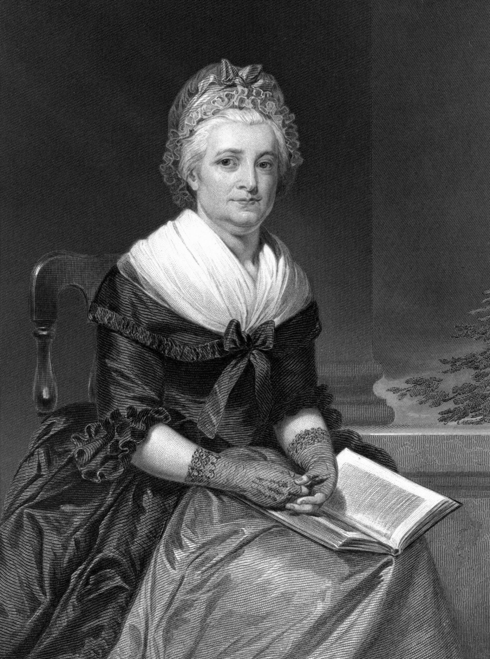
The Founding Mothers operated largely without formal power, yet their influence was decisive. Martha Washington spent roughly half of the war at her husband’s side, traveling to encampments at Valley Forge, Morristown, and Newburgh. She organized fund-raising and clothing drives, comforted the wounded, and served as Washington’s personal secretary. Mount Vernon records describe her as a woman whose “presence not only fortified her husband but helped boost the morale of the entire camp.”2 After the war, historians David S. Shields and Fredrika J. Teute identify her as the founder of the “Republican Court, the weekly Friday drawing room she inaugurated at the president’s house in New York in 1788, which promoted republican manners and united the new nation’s governing class.3 Abigail Adams wielded the power of argument and intellect. Her 1776 admonition to John Adams to “remember the ladies” in forming new laws is one of the most recognized statements from the founding generation, and her sustained correspondence preserved in full by the Massachusetts Historical Society shaped her husband’s thinking throughout the Revolutionary era.4 As first lady, she extended the Republican Court’s reach further still, becoming “a broker of patronage, and conduit of information to newspapers, [and] a counselor to the president,” extending women’s purview in public life well beyond the president’s private home.5
Another woman, though not a First Lady, associated with the revolutionary era was Mercy Otis Warren. A playwright, poet, and historian, she published History of the Rise, Progress, and Termination of the American Revolution in 1805 at age seventy-seven. This was the only Anti-Federalist account written by a participant. She was quite literally a witness to the American Revolution who used her words to further the cause of human freedom.6 Today, the Library of Congress and other archives and libraries document the lives of dozens of women like her, whose surviving diaries and other written records shed light on their work as spies, nurses, fundraisers, and managers of farms and businesses that kept the Continental Army supplied.7
The patriotic heritage movement gained momentum in the late nineteenth century as grandchildren of Revolutionary veterans sought formal ways to honor their forebears. On April 30, 1889, the centennial of Washington’s first inauguration, William Osborn McDowell organized the Sons of the American Revolution (SAR) at Fraunces Tavern in New York to perpetuate “a more profound reverence for the principles of the government founded by our forefathers.”8 Women who traced their ancestry to Revolutionary patriots sought to join the SAR, but in 1890 the organization voted to exclude them. Four women took matters into their own hands, and on August 9, 1890, Mary Desha, Eugenia Washington, and Ellen Hardin Walworth met in Washington, D.C., to draft founding documents for a new women’s organization. Mary Smith Lockwood joined the effort, and on October 11, 1890, they formally established the National Society Daughters of the American Revolution (DAR).9 First Lady Caroline Scott Harrison became the first President General, and the DAR’s inaugural project was a monument in Fredericksburg, Virginia, marking the birthplace of Mary Ball Washington, George Washington’s Mother, as a declaration that the republic had mothers as well as fathers.10
The DAR’s founding in 1890 coincides with Idaho’s admission to the Union on July 3, 1890. Women who arrived in Idaho after statehood brought their DAR membership with them from the East and Midwest. According to the University of Idaho Library’s Idaho Harvester, the first Idahoan to join DAR was Mary Gridley Tarr, who moved to Teton Basin in 1902 and was elected Organizing Regent at the 1904 Continental Congress. Her leadership produced the Idaho State DAR’s formal organization in 1909.11 The Pioneer Chapter of Boise was active the same year. Boise’s Evening Capital News reported its members and noted that several other chapters were forming across the state.12
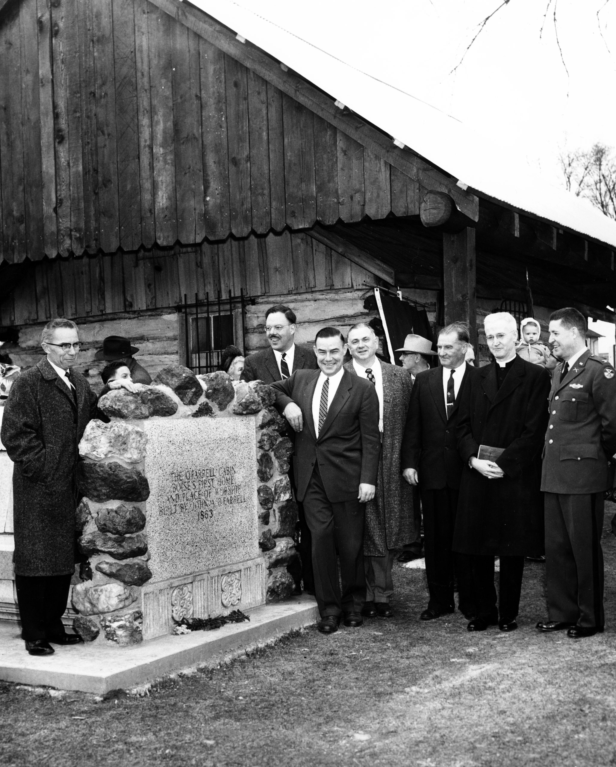
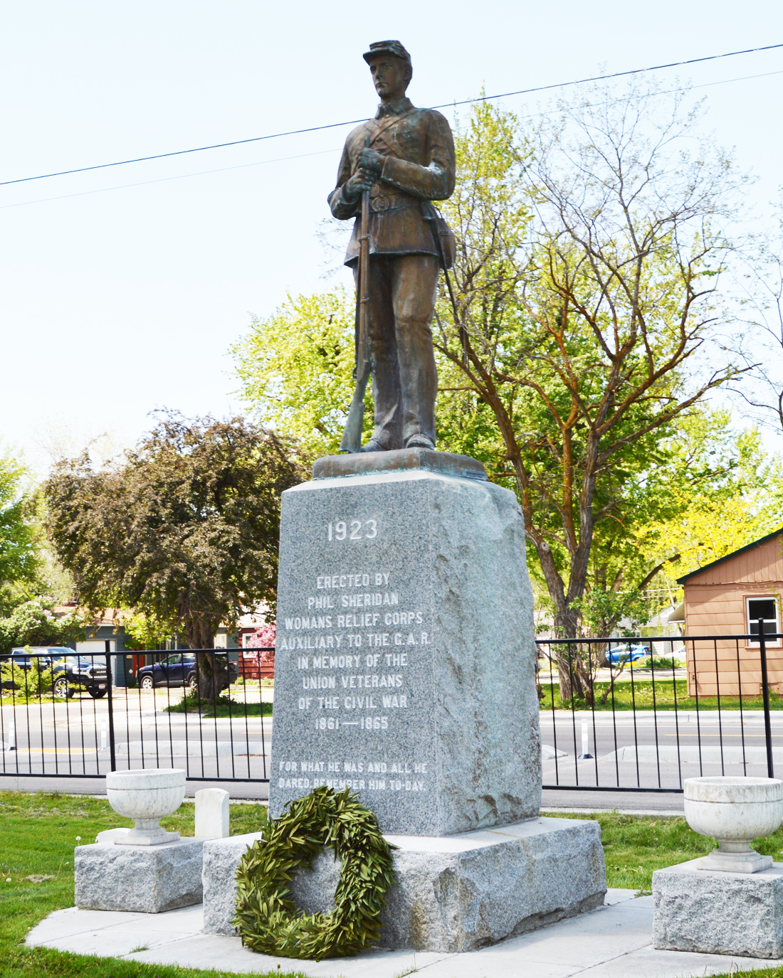
Today, the Idaho DAR reflects fifteen chapters, bearing names drawn from the state’s layered past: Old Fort Hall, the Oregon Trail outpost; Alice Whitman, the Pacific Northwest missionary; Emma Edwards Green, the only woman ever to design a state seal.13 Their service record is equally storied. Since the early 1900s, they have taken their charge to promote patriotism, education, and historic preservation seriously. The Pioneer Chapter’s 1911 preservation of the O’Farrell Cabin, built in 1863 as Boise’s first family home, established a standard that preceded any state preservation program; a bronze plaque above the door reads, “This was the first home in Boise to shelter women and children. Restored and preserved by the Pioneer Chapter, DAR.”14 In 2019, that chapter placed a marker at the Idaho Black History Museum honoring Elvina Moulton, a formerly enslaved woman who walked the Oregon Trail to Boise around 1867 and helped found the city’s First Presbyterian Church in 1878.15 In 2025, the Ee-dah-how and Pioneer Chapters brought the American Revolution Experience exhibition to the Idaho State Capitol rotunda in partnership with the American Battlefield Trust,16 and in September 2024, the Lieutenant George Farragut Chapter dedicated an America250 Patriots Marker at Independence Point in Coeur d’Alene, part of a DAR and William G. Pomeroy Foundation effort to place 250 markers ahead of the nation’s semiquincentennial.17
The women who organized the DAR in 1890 understood something that Martha Washington, Abigail Adams, and Mercy Otis Warren had each demonstrated in their own time: that patriotism is not passive. It demands presence at the encampment, a letter written at the right moment, and a history preserved so that no one forgets. When Idaho women organized their first chapter and saved the oldest cabin in Boise, they carried that tradition forward. The fifteen chapters active across Idaho today continue to prove that the legacy of the founding generation belongs not only to those who lived it, but to every generation willing to keep it alive.
If you believe you have an ancestral lineage to an American Patriot, consider contacting the DAR or SAR about membership.
Bibliography
“Abigail Adams | George Washington’s Mount Vernon.” Accessed May 20, 2026. https://www.mountvernon.org/library/digitalhistory/digital-encyclopedia/article/abigail-adams.
“Adams Papers Digital Edition – Massachusetts Historical Society.” Accessed May 20, 2026. https://www.masshist.org/publications/adams-papers/.
American Battlefield Trust. “Interactive American Revolution Experience Exhibit Arrives at Idaho State Capitol.” March 24, 2025. https://www.battlefields.org/news/interactive-american-revolution-experience-exhibit-arrives-idaho-state-capitol.
Article, Michael Katz Gift. “100 Years after Her Death, Boise’s 1st Documented African-American Woman Is Memorialized.” Idaho Statesman, April 27, 2019. https://www.idahostatesman.com/latest-news/article229642809.html.
“At the Front | George Washington’s Mount Vernon.” Accessed May 20, 2026. https://www.mountvernon.org/george-washington/martha-washington/martha-at-the-front.
Daughters of the American Revolution. “The Founding of the DAR.” Accessed May 20, 2026. https://www.dar.org/national-society/about-dar/dar-history/founding-dar.
Idaho State Society, NSDAR. “Chapters.” Accessed May 20, 2026. https://www.issdar.org/chapters.html.
“Key Facts About Martha Washington | George Washington’s Mount Vernon.” Accessed May 20, 2026. https://www.mountvernon.org/george-washington/martha-washington/keys-fact-about-martha-washington.
“Mercy Otis Warren | George Washington’s Mount Vernon.” Accessed May 20, 2026. https://www.mountvernon.org/library/digitalhistory/digital-encyclopedia/article/mercy-otis-warren-1728-1814.
“National Register of Historic Places Registration Form, O’Ferrel, John A. Cabin.” United States Department of the Interior, October 19, 1999.
“‘Patriots’ Marker to Be Dedicated Saturday | Coeur d’Alene Press.” Accessed May 20, 2026. https://cdapress.com/news/2024/sep/18/marker-dedicates-patriots/.
Roberts, Cokie. Founding Mothers: The Women Who Raised Our Nation. First edition. William Morrow, 2004.
Shields, David S., and Fredrika J. Teute. “The Court of Abigail Adams.” Journal of the Early Republic 35, no. 2 (2015): 227–35.
“Sons of the American Revolution History.” Accessed May 20, 2026. https://www.sarsandiego.org/about-sar-detail/.
Spencer, Erika Hope. “Research Guides: France: Women in the Revolution: Women in the American Revolution.” Research guide. Accessed May 20, 2026. https://guides.loc.gov/women-in-the-french-revolution/women-american-revolution.
Szobody, Sara. “Daughters of the American Revolution.” Idaho Harvester. Accessed May 20, 2026. https://harvester.lib.uidaho.edu/posts/2022/07/04/daughters-of-the-american-revolution.html.
The Idaho Statesman (Boise, Idaho). “Club Notes.” February 7, 1909.
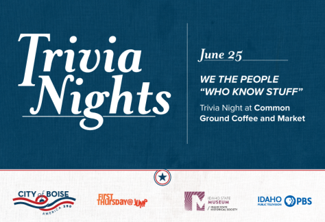
We the People “Who Know Stuff” Trivia Night
EVENT DETAIL-
00
days
-
00
hours
-
00
minutes
-
00
seconds